
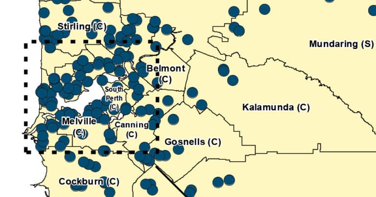

New heat map from the Department of Health highlights Perth coronavirus hotspots
As announced today by WA Health Minister Roger Cook, the WA Department of Health were to launch a Perth coronavirus heat map.

The purpose of the heat map is to allow Western Australians will to see at a glance the State’s COVID-19 hotspots.
The heat map is a graphical representation of confirmed coronavirus case data to give Western Australians a quick impression of the location of cases in our State.

But it’s not just for the Perth metro area, the map will display both regional and metropolitan activity by local government area.
The map will not reveal the exact location of individual cases, ensuring patient confidentiality.
Twitter: WA Department of Health media statement – New heat map highlights COVID-19 hotspots
The map will be updated daily and can be viewed on the Department of Health site health.wa.gov.au.
More coronavirus coverage on SoPerth.com.au:
Breaking: Andrew ‘Twiggy’ Forrest Donates $160 Million To Fight Coronavirus