

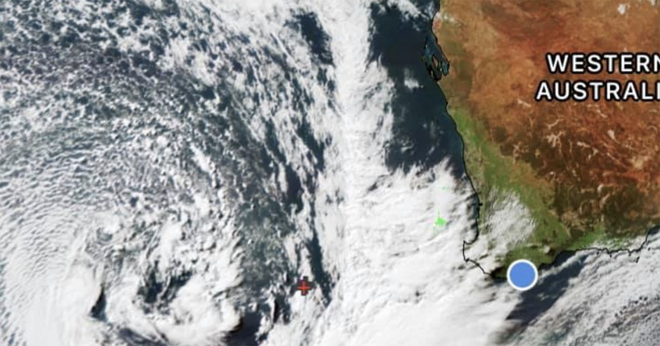
Perth storm alert – the strongest cold front this year will arrive Monday morning.
Since when does it rain in Perth? Well, all the time of the past week is anything to go by as Bureau of Meteorology issue another Perth storm weather warning for Monday for the south west of Western Australia.
Weather Alert
This front is expected to be windier than a typical front and is likely to produce the kind of weather that is only seen about 1-2 times per year.
Damaging winds with gusts in excess of 100 kilometres per hour are likely and could cause damage to homes and properties.
Winds across coastal areas of the Lower West and South West will strengthen on Monday morning and then extend further inland as the cold front traverses the South West Land Division.
Winds may temporarily ease for a period following the passage of the front, however further damaging winds are likely later on Monday and during Tuesday as squally conditions persist.
Bureau of Meteorology has also noted higher than normal tides may cause flooding with the morning high tide on Monday and Tuesday from Shark Bay to Albany including the Swan River.
Heavy rainfall is also expected which may lead to flash flooding during Monday morning with the passage of the front, particularly around the Darling Scarp.
The rainfall will ease to squally showers and thunderstorms on Monday afternoon, continuing through Tuesday.
Twitter: The strongest cold front this year will arrive Monday morning
☔💨The strongest cold front this year will arrive Monday morning bringing squally weather including the potential for damaging winds with gusts of more than 100 kilometres per hour along the west coast and south west regions of WA. Check warnings here: https://t.co/LZgrYxjGXi pic.twitter.com/cAv3KGxHml
— Bureau of Meteorology, Western Australia (@BOM_WA) July 11, 2021
Locations on alert
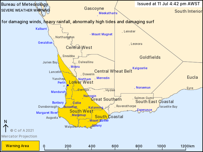
Locations that may be affected include:
- Albany
- Bunbury
- Katanning
- Mandurah
- Manjimup
- Margaret River
- Mount Barker
- Narrogin
- Northam
- Perth.
Emergency advice
The Department of Fire and Emergency Services advises that people should:
- If outside find safe shelter away from trees, power lines, storm water drains and streams.
- Close your curtains and blinds, and stay inside away from windows.
- Unplug electrical appliances and do not use land line telephones if there is lightning.
- If boating, swimming or surfing leave the water.
- Be alert and watch for hazards on the road such as fallen power lines and loose debris.
- Keep away from flooded drains, rivers, streams and waterways.
- Be careful of fallen trees, damaged buildings and debris.
- Be careful of fallen power lines. They are dangerous and should always be treated as live.
- Assess your home, car and property for damage.
- If damage has occurred take photos and contact your insurance company to organise permanent repairs.
- If your home or property has significant damage, like a badly damaged roof or flooding, call the SES on 132 500.
Crazy footage as Subiaco floods
On Friday footage emerged of Hay St in Subiaco with significant flooding.
Optus Stadium disappears during Perth storm
In February 2020 footage shows Optus Stadium disappear as heavy rainfall overtakes Perth.
More Perth news on SoPerth.com.au.