


Perth Lightning Storm : Major Damage at Rockingham, Perth Coast
Perth Lightning Storm : The storm cell that swept through Perth today was pretty crazy by the looks of it.
Some spectacular snaps were taken as it came in.
On Twitter Tracey Schmidt shared the above cracker image (literally a cracker of lightning) near the Kwinana grain terminal.
Here’s some of the best floating around social media of the Perth Lightning Storm.


Perth Storms February 25 2018.
Roofs have been damaged, trees and infrastructure have been pulled from the ground, as winds, rain and thunderstorms lash Perth.

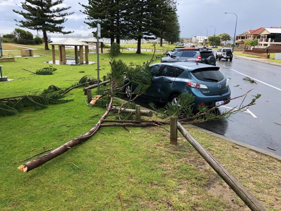
Photos from Rockingham posted on Perth Weather Live Facebook show serious looking damage in Rockingham, with at least one car damaged from falling pine trees.
The playground at the Rockingham foreshore looks like a bomb hit, with a number of objects blown away.

Trees and power poles are also damaged, with a number of photos showing the damage. Perth Lightning strikes recorded at high pace, by BOM.

An apartment block also looks to have been seriously damaged.
Winds of up to 130km/h were recorded at coastal Perth suburbs. It appears Rockingham took the biggest storm cell around 11am.


@perthnow #perthnews #perthstorm ☔ pic.twitter.com/SFxGyyrhHN
— Larissa (@larissajayne9) February 25, 2018
Earlier, storms and rain had been predicted for the last Sunday in February for Perth:
Bad weather is coming to Perth on the last Sunday of Summer 2017/2018.
Perth Lightning Storm : There’s a High (80%) chance of showers or a thunderstorm, most likely in the morning and early afternoon.
The day will still be warm with 29 degrees a top.
Winds easterly 25 to 35 km/h tending northeasterly 20 to 30 km/h in the morning then becoming light in the middle of the day.
Showers are expected for the south west of WA as well as a cold mass of air moves through.
More forecasts for the week from BOM:
Monday: 25. Cloudy. Medium (40%) chance of showers and thunderstorms in the morning, clearing to a partly cloudy day. Slight (20%) chance of showers developing in the evening. Light winds becoming southwesterly 20 to 30 km/h in the morning.
Tuesday : 24. Partly cloudy. Slight (20%) chance of a shower near the coast in the morning. Winds south to southeasterly 15 to 25 km/h tending south to southwesterly 20 to 30 km/h during the afternoon then tending south to southeasterly 15 to 25 km/h during the evening.